
Pecan Grove ZIP Code Directory Coverage
Pecan Grove is an unincorporated Fort Bend County CDP, so postal geography needs careful reading. Census associates the Pecan Grove CDP with 77406 and 77407. Those associations are useful starting points, not proof that every Pecan Grove delivery uses one of those codes. The Richmond mailing label appears widely in county and district records, but Pecan Grove has no post office of its own and a postal city is not a municipal boundary.
| ZIP | Areas Covered | Post Office | Notes |
|---|---|---|---|
| 77406 | Core Richmond mailing area containing most Pecan Grove references | Richmond Main Office | Verify a specific delivery address; postal coverage is not a city-limit line. |
| 77407 | ZCTA associated with the Pecan Grove CDP in the Census profile | Richmond Main Office | Not every Pecan Grove street is established as 77407; it was part of the 2008 realignment. |
| 77469 | Historic Richmond delivery area used before the realignment | Richmond Main Office | Search this code in older deed, tax, directory, and newspaper material. |
| 77479, 77459, 77489, 77441 | Nearby Fort Bend areas, not established as core Pecan Grove coverage | Varies by area | A street name containing “Pecan” is not enough to include an address in Pecan Grove. |
The Census Pecan Grove profile supplies the place-level ZCTA association used in this ZIP code directory.
Census geography gives context for the CDP, while USPS validates a delivery address and county GIS explains the nearby jurisdiction layers.
Pecan Grove ZIP Code Directory History
Historical research needs a three-code search. USPS Postal Bulletin 22233 records a July 1, 2008 Richmond realignment in which 9,723 deliveries moved from 77469 to 77406 and 7,848 deliveries moved from 77469 to newly established 77407. A pre-2008 instrument, tax item, newspaper notice, or address list can therefore contain 77469 even when an address now verifies under 77406 or 77407.
USPS Postal Bulletin 22233 records the Richmond delivery realignment behind this historical Pecan Grove ZIP code directory check.
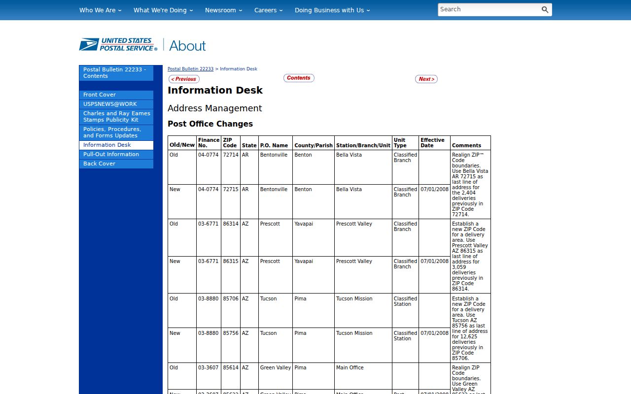
The old code is an address-history clue, not evidence that a person or parcel changed community.
Note: Search 77469 alongside current codes when an older Pecan Grove record appears to be missing from an address query.
Pecan Grove ZIP Code Directory GIS Fields
Fort Bend County's public address-point service provides the most direct county view of mailing and jurisdiction data in one place. Search or locate an address in the interactive map, inspect the point, and compare its postal fields with the ZIP, City Limits, City ETJ, subdivision, neighborhood, MUD, and parcel layers. The address point does not name every resident. It helps establish how the county stores and maps the address.
| Address-point field | What it records |
|---|---|
| STREET_NUM | Street number for the mapped address point. |
| STREET_NAME | Street name used with the address point. |
| STREET_SUF | Street suffix recorded for the address. |
| POSTAL_CITY | Postal city used for delivery addressing. |
| ZIP_CODE | ZIP code stored with the address point. |
| ADD_CITY | City, ETJ, or unincorporated classification for the address. |
| ADD_HISTORY | Address-history information that can help resolve an older record. |
Fort Bend Address Points documents the fields used for these Pecan Grove ZIP code checks.
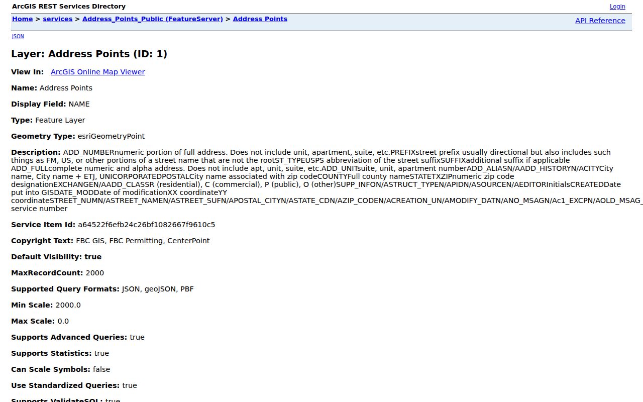
POSTAL_CITY and ADD_CITY are deliberately separate, which is valuable when a Richmond mailing label and an unincorporated classification appear together.
Pecan Grove ZIP Code Boundary Checks
Fort Bend GIS publishes delivery and jurisdiction layers side by side. Turn on ZIP Codes, City Limits, City ETJs, subdivisions, MUDs, and parcels before deciding which office has a record. A ZIP is a delivery route. A Census ZCTA is statistical geography. A city limit, ETJ, MUD, school district, precinct, and subdivision are different map areas. One address can be connected to several of them at once.
Fort Bend InteractiveMap services list the public address, boundaries, parcel, election, engineering, and water-district resources available for this comparison.
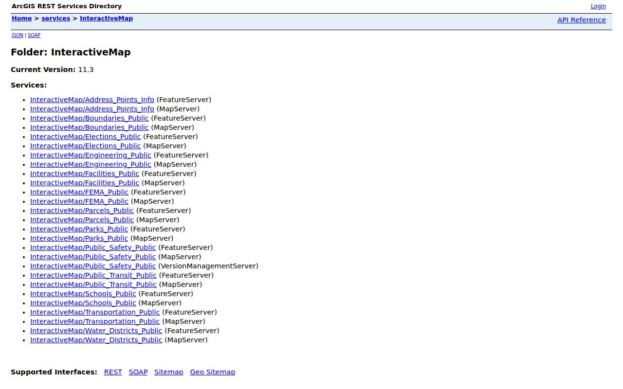
Map verification is particularly important because Pecan Grove is unincorporated and is associated with Richmond ETJ and MUD geography.
Finding Residents in Pecan Grove ZIP Codes
There is no public resident roll that can be reliably browsed ZIP-wide. Start by verifying the delivery address, then translate the ZIP into an address, street segment, subdivision, or parcel. FBCAD has no visible ZIP field in its public property form. It accepts owner, street, subdivision, neighborhood, quick-reference ID, geographic ID, property type, and tax-year inputs instead. GIS supplies the ZIP and postal-city context needed before using those property fields.
- Use an exact address with the official USPS ZIP Code Lookup to verify the current delivery code.
- Locate that address in Fort Bend GIS and record ZIP_CODE, POSTAL_CITY, ADD_CITY, street fields, subdivision, and parcel context.
- Use the street, subdivision, neighborhood, or geographic ID in FBCAD, then distinguish the owner mailing address from the property situs.
- For an older record, repeat the search with 77469 as well as the current ZIP and use ADD_HISTORY or the legal description if formatting changed.
Texas My Voter Portal checks an individual's status through identity and county fields. It is not a ZIP-wide browse tool, and broader voter data must use the custodian's request process with its restrictions. Once a ZIP is narrowed to a named street, the Pecan Grove street directory provides the address-by-address record trail.
Pecan Grove ZIP Code Directory Parcel Search
ZIP alone will not find a property account in FBCAD. Search a street name when the exact address fails, or use the subdivision and neighborhood terms shown in GIS. Pecan Grove MUD identifies communities including Pecan Grove Plantation, The Grove, The Greens, Plantation Place, Pecan Lakes, and The Terrace. Those are useful field values to compare with an address point and legal description, but they should not be treated as a complete household list.
FBCAD can show owner name, owner mailing address, property location or situs, legal description, values, taxing units, and account identifiers. The County Clerk's deed index uses parties and legal descriptions rather than a guaranteed street-address key. For a historic parcel trail, keep the ZIP with the research notes but let the legal description bridge the property record and recorded instrument.
Pecan Grove ZIP Code Directory and City Limits
“Richmond, TX” on an envelope does not establish that a Pecan Grove address lies within Richmond city limits. Pecan Grove is unincorporated, and its relationship to Richmond is commonly expressed through postal, ETJ, and MUD geography. Verify the specific parcel in the county map before routing a records question to a city office or describing an address as incorporated. There is no Pecan Grove city hall or municipal court for this ZIP code directory to consult.
Map first. Compare the ZIP layer with City Limits, City ETJs, subdivisions, MUDs, and the parcel before making a jurisdiction claim. A postal code is useful for delivery, not a substitute for the county's boundary record.
- ZIP and ZIP+4
- A ZIP groups a delivery area. ZIP+4 adds a smaller delivery segment and is not a property boundary.
- PO-box ZIP
- A code assigned to post-office boxes. It can differ from the code used to deliver to a street address.
- Unique ZIP
- A code assigned to one organization or facility. No unique Pecan Grove ZIP was established in the research.
- Carrier route
- A postal delivery sequence. It helps mail delivery and does not prove residency or jurisdiction.
Historic Pecan Grove ZIP Code Trails
Older Fort Bend material often needs more than the modern address. Pecan Grove's development began in the 1970s, so earlier land records may use a legal description, plat, rural route, or Richmond reference rather than a present subdivision street. The County Clerk's recorded-instrument trail and the county GIS address history are stronger bridges than guessing that a current delivery code existed at the time.
For a family or estate question, pair the historical ZIP notes with probate, deed, obituary, and local-library searches. George Memorial Library's genealogy collection and the Texas State Library's Fort Bend microfilm guide can supply older county context when a modern ZIP is not useful. The historical material may be indexed by names, record series, volume, reel, or legal description instead of delivery address. A 1962 directory or an early deed should never be forced into a current Pecan Grove street format.
Keep a dated log of each spelling, street form, ZIP, parcel identifier, instrument number, and map layer checked. That record makes it clear whether a failed result reflects the 2008 ZIP change, an unincorporated address, a different street format, or a genuinely different parcel. It also makes a later counter, mail, or public-information request more precise because the custodian can see the series and dates already checked.
Pecan Grove ZIP Code Address Validation
For a new or changed physical address, Fort Bend GIS directs users to CenterPoint Energy and provides a Physical Address Verification Form route. County Engineering handles unincorporated development, address-verification, and power-release work. The posted fees list $25 for address verification or power release and $30 for a change of address. Those procedures address the physical address, not a promise that a ZIP code identifies current residents.
When a record does not line up, verify the delivery address with USPS, inspect the county address point, and preserve the parcel's legal description. Ask the appropriate custodian for a specific record series if a needed public file is not online. That sequence keeps the Pecan Grove ZIP code directory focused on delivery geography, recorded evidence, and the real limits of each source.